
Cape Carteret was created by William Britton McLean on property Mr. McLean purchased from Anita Fort Maulick. McLean, born in 1911 in Red Springs, North Carolina, attended Virginia Military Institute and the University of North Carolina at Chapel Hill. He enlisted in the Army during WWII, serving in North Africa and Italy.
Following the surrender of Nazi Germany and the bombing of Hiroshima and Nagasaki, McLean returned to Red Springs to resume farming and join his long-time business partner, George F. Spell in two car dealerships.
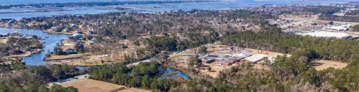
In 1946, McLean and two partners purchased timber from Emerald Isle for his saw mill operation. Later, McLean and other partners purchased what is now the Town of Emerald Isle from Mrs. Maulick. McLean, himself, also purchased property on the mainland from Mrs. Maulick which is now “Old Cape Carteret.” (One of the main streets, with a one hundred-foot right-of-way, was named Anita Forte, in memory of Mrs. Maulick. The “e” inadvertently added to her maiden name, “Fort”, by the surveyor remains in use in some applications to this day). In 1958 this became the first residential subdivision recorded in Cape Carteret, extending from Anita Fort Dr. west to NC 58.
With the incorporation of Cape Carteret in June 1959 and continued development on Emerald Isle, access to the western end of the island became a priority for businesses and residents alike. The only access to Emerald Isle was through Morehead City and across the bridge in Atlantic Beach. Requests to the State for a ferry service went unfulfilled. Mr. McLean, never known for his patience, began dredging a channel from Lejeune Road in Bayshore Park across Bogue Sound to what is now Island Harbor Marina on Emerald Isle. He then purchased surplus car ferries in Virginia and parked them at 565 Neptune Drive until the ferry docks were completed.
The ferries, however, were never used. In 1961 the State of North Carolina began daily ferry service to and from Emerald Isle. The now demolished Harborlight Bed and Breakfast was built as a restaurant to serve the ferry traffic. Ferries ran on the hour in the winter and on the half-hour during the summer. Ferry service continued until the Cameron Langston Bridge to Emerald Isle was completed in 1971. All that remains of the ferry service is the bulkheads at the end of Lejeune Road, a few pilings, and the channel that is still regularly used by boaters to get to the Intracoastal Waterway.
In 1960 McLean bought a farm from C.C. Dennis and his wife in the area that is now Bayshore Park. Following this acquisition, Mr. McLean and his long-time partner, George F. Spell, acquired the parcels that are now Star Hill and Country Club Point. They were later joined by a third partner, William A. Shackleford, Jr. in a venture to develop the golf course, which opened as an 18-hole course in 1968. The grass landing strip, running through the middle of the golf course, was used by locals and weekend visitors and, at one time, had tie-downs for twenty-two airplanes and night landing lights.
By 1974 the town had adopted zoning regulations that largely remain in effect today. The Town is governed by an elected five-member Board of Commissioners and a separately elected, non-voting Mayor. The Town has an appointed Board of Adjustment for reviewing variance requests and an appointed Planning Board for review of changes to the zoning code, subdivision plat review, and commercial site plan review. A Town staff of 15 employees provides administrative, planning and zoning, law enforcement, and public works services to the community. A regional department provides fire and emergency medical services to Cape Carteret and other communities in western Carteret County.